(Added church to the description.) |
@DeletedUser40350355 (talk | contribs) (deleted tank station info) |
||
| Line 10: | Line 10: | ||
|biome = [[Forest]]<br>[[Burnt Forest]]<br>[[Desert]]<br>[[Wasteland]] |
|biome = [[Forest]]<br>[[Burnt Forest]]<br>[[Desert]]<br>[[Wasteland]] |
||
|}} |
|}} |
||
| − | '''{{PAGENAME}}''' is one of the many [[Roads]] in [[Navezgane]]. It runs directly from the Southern most point of [[Navezgane]] up to the center of the map where it meets up with [[Arrowhead St]] and [[Maple Rd]]. There is a [[ |
+ | '''{{PAGENAME}}''' is one of the many [[Roads]] in [[Navezgane]]. It runs directly from the Southern most point of [[Navezgane]] up to the center of the map where it meets up with [[Arrowhead St]] and [[Maple Rd]]. There is a [[Church]] at the north end between [[Highway 260]] and [[Maple Rd]]. {{PAGENAME}} is one of the few roads in the [[Navezgane|county]] that runs through multiple [[biome]]s and isn't a [[highway]]. |
== Location == |
== Location == |
||
Revision as of 14:41, 14 June 2014
You can help 7 Days to Die Wiki by expanding it.
| Apache St | |
|---|---|
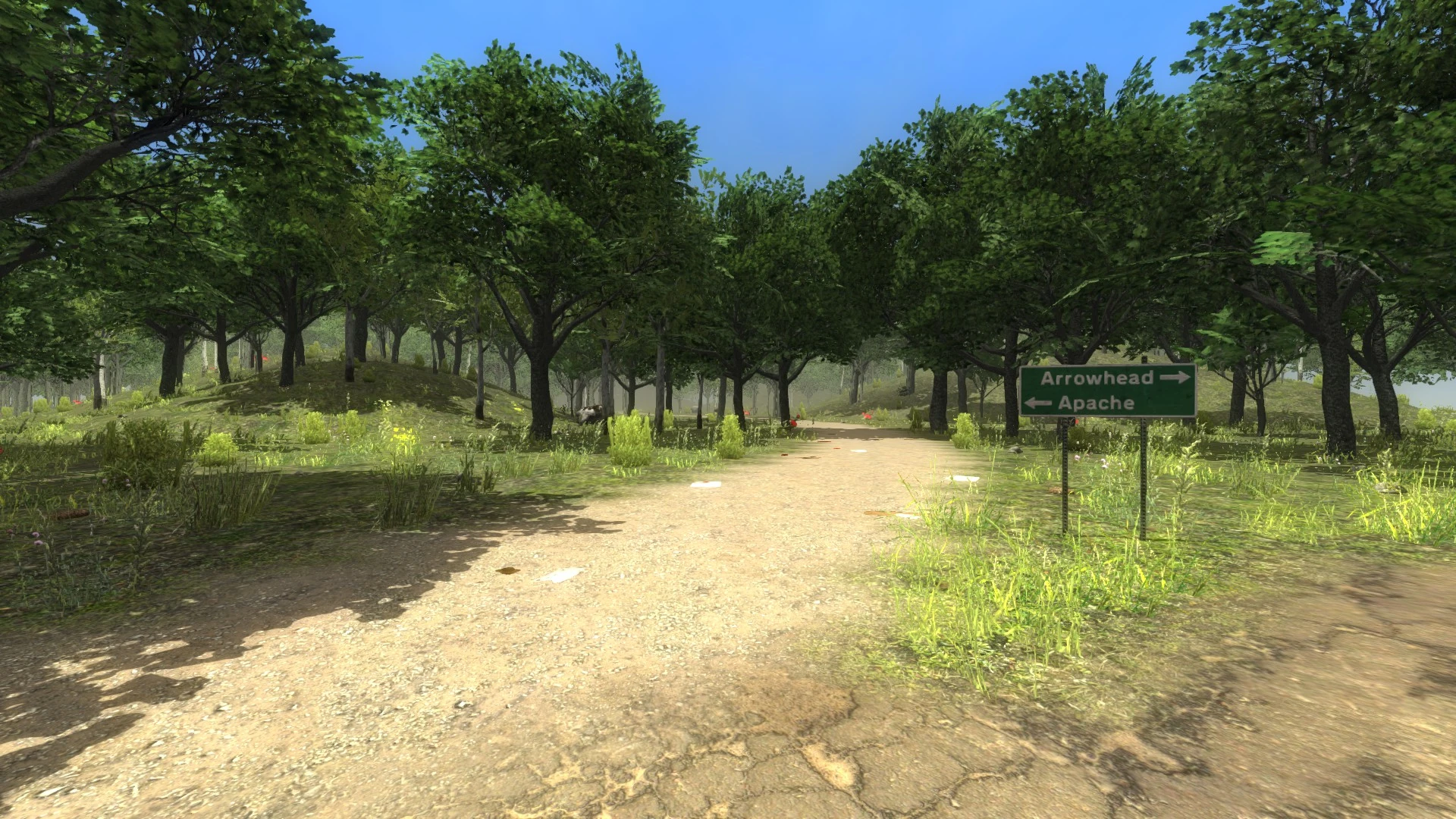 Apache St Road Sign | |
| Description | |
| Category | Street |
Apache St is one of the many Roads in Navezgane. It runs directly from the Southern most point of Navezgane up to the center of the map where it meets up with Arrowhead St and Maple Rd. There is a Church at the north end between Highway 260 and Maple Rd. Apache St is one of the few roads in the county that runs through multiple biomes and isn't a highway.
Location[ | ]
Apache Sts location in Navezgane