No edit summary |
@DeletedUser40610358 (talk | contribs) m (Gravetown > Gravestown) |
||
| (3 intermediate revisions by 2 users not shown) | |||
| Line 4: | Line 4: | ||
|size = 350px |
|size = 350px |
||
|category = Highway |
|category = Highway |
||
| − | |biome = [[ |
+ | |biome = [[Burnt Forest]]<br>[[Rural Area]] |
| + | |navezgane = Y |
||
| + | |confirmed_version = Alpha 15 |
||
|}} |
|}} |
||
| − | '''{{PAGENAME}}''' along with [[Highway 73]] is one of the two main roads in [[Navezgane]]. It spans the width of the map and runs east and west through the centre of the map. There is an [[Army Recon Campsite]] to the south of this highway |
+ | '''{{PAGENAME}}''' along with [[Highway 73]] is one of the two main roads in [[Navezgane]]. It spans the width of the map and runs east and west through the centre of the map. There is an [[Army Recon Campsite]] to the south of this highway were [[Dishong Pass]] connects. |
| − | |||
| − | The following roads intersect or connect to Highway 260 from east to west are:<br>[[Old Mole]]<br>[[Dishong Pass]]<br>[[Courtland St]]<br>[[Apache St]]<br>[[Lang Rd]]<br>[[Scenic Overlook]]<br>[[Highway 73]]<br>[[Davis Rd]]<br>[[Gore Rd]] |
||
As with both highways you can expect to find a fair amount of [[Decayed Sedan|cars]] scattered along the road and occasionally bump into a wreck with several [[Crawler Zombie|crawlers]] and [[Zombie Dog]]s. |
As with both highways you can expect to find a fair amount of [[Decayed Sedan|cars]] scattered along the road and occasionally bump into a wreck with several [[Crawler Zombie|crawlers]] and [[Zombie Dog]]s. |
||
| − | {{PAGENAME}} is to the south of [[Diersville]], head north on [[Courtland St]] to reach. {{PAGENAME}} is to the north of [[ |
+ | {{PAGENAME}} is to the south of [[Diersville]], head north on [[Courtland St]] to reach. {{PAGENAME}} is to the north of [[Gravestown]], head south-west on [[Lang Rd]] or south on [[Highway 73]] to reach. |
| + | |||
| + | == Connecting Streets == |
||
| + | The following roads intersect or connect to Highway 260 from east to west. |
||
| + | *[[Old Mole]] |
||
| + | *[[Dishong Pass]] |
||
| + | *[[Courtland St]] |
||
| + | *[[Apache St]] |
||
| + | *[[Lang Rd]] |
||
| + | *[[Scenic Overlook]] |
||
| + | *[[Highway 73]] |
||
| + | *[[Davis Rd]] |
||
| + | *[[Gore Rd]] |
||
==Notes== |
==Notes== |
||
Revision as of 22:56, 22 January 2017
| Highway 260 | |
|---|---|
 A bare road awaits ahead, from the West end of Highway 260 | |
| Description | |
| Category | Highway |
| Game Worlds
| |
| Navezgane | Yes |
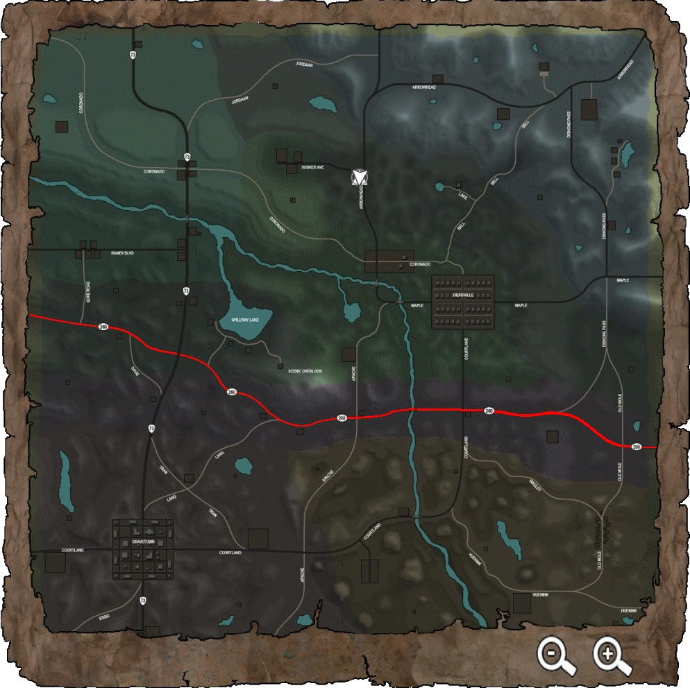
Highway 260 along with Highway 73 is one of the two main roads in Navezgane. It spans the width of the map and runs east and west through the centre of the map. There is an Army Recon Campsite to the south of this highway were Dishong Pass connects.
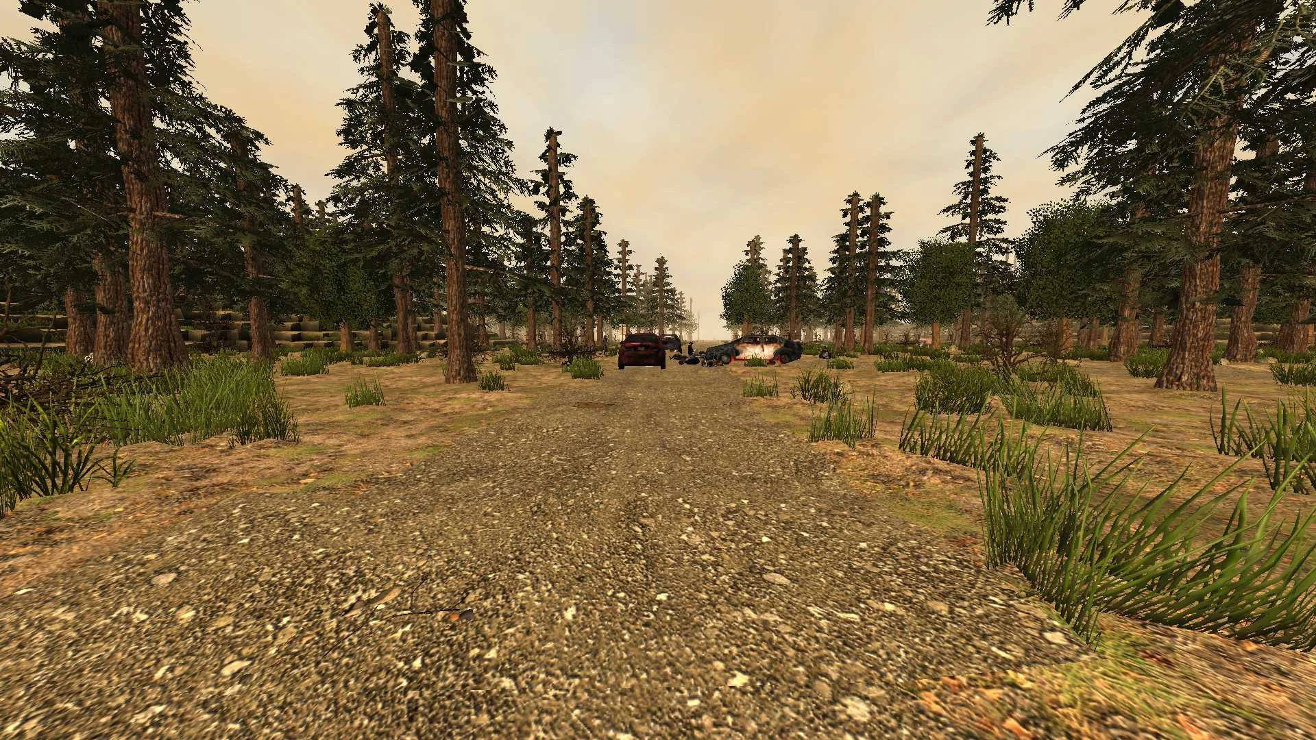
As with both highways you can expect to find a fair amount of cars scattered along the road and occasionally bump into a wreck with several crawlers and Zombie Dogs.
Highway 260 is to the south of Diersville, head north on Courtland St to reach. Highway 260 is to the north of Gravestown, head south-west on Lang Rd or south on Highway 73 to reach.
Connecting Streets[ | ]
The following roads intersect or connect to Highway 260 from east to west.
Notes[ | ]
- There are a total of 22 cars along Highway 260. This takes into account cars that can be seen from Highway 260 with a view distance of 9 and a quick sprint to search them.
Images[ | ]

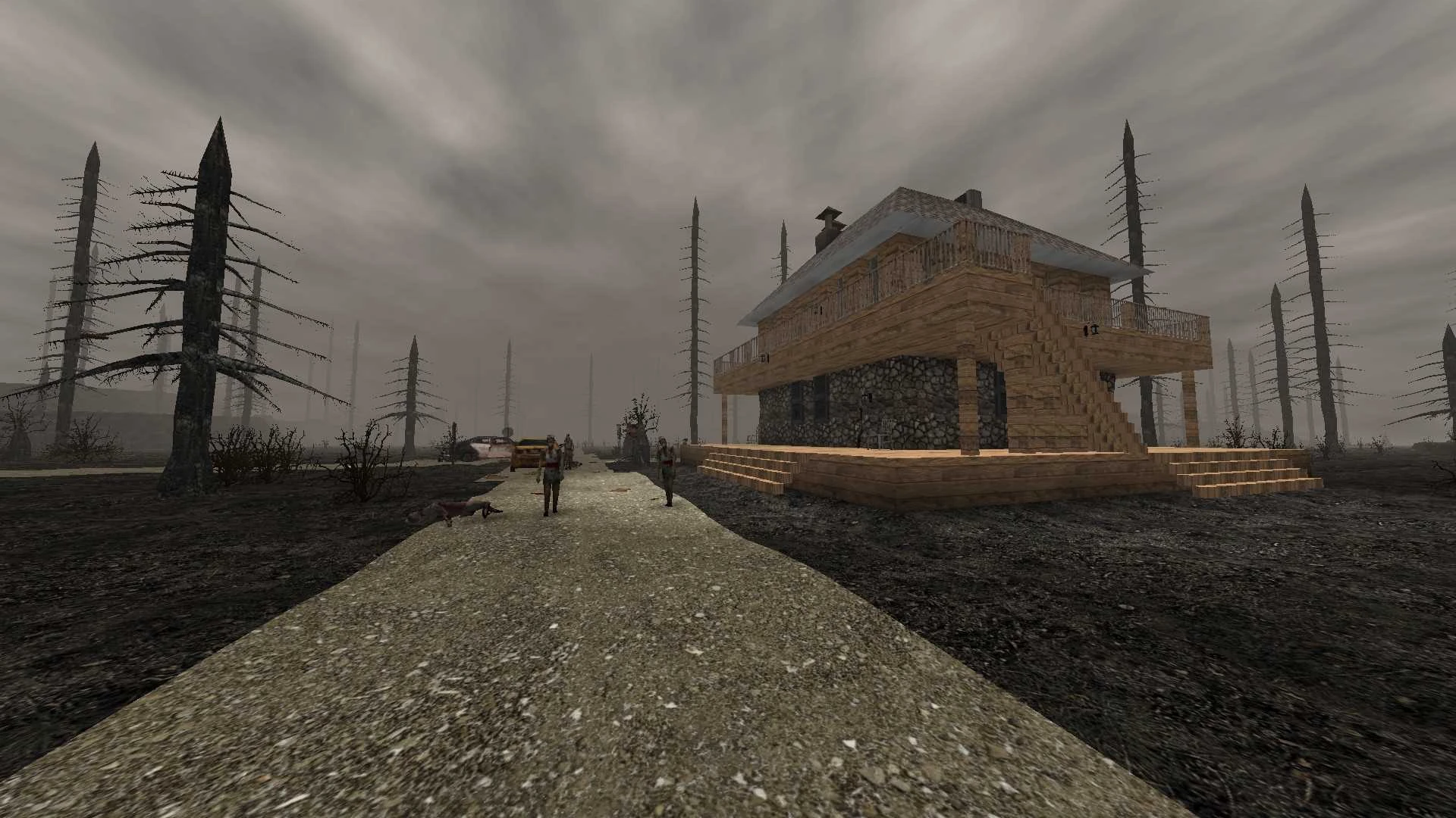
A derelict house surrounded with zombies along Highway 260

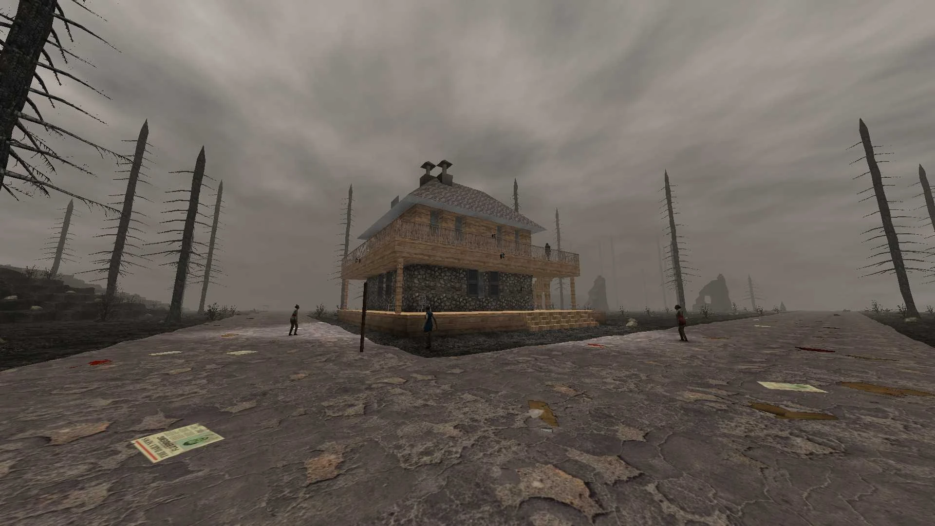
Another view of the house that is situated near the centre of Highway 260

Location of Highway 260 on the Navezgane Map